LiDAR to CAD
Contours and terrain models from Environment Agency LiDAR or your own point cloud, drawn on your site plan as layered DWG and DXF, with PDF sheets ready to print.
SURVEY DATA PROCESSING · ROME, ITALY · INTERNATIONAL PROJECTS
Contours, terrain models, cut and fill, and Metashape processing for surveyors, golf architects and contractors, from someone who spent 35 verifiable years building golf courses.
You send drone images, a point cloud, or just a site boundary. You get back CAD-ready files, with the accuracy stated and the method written down.
Every job goes through the same checks before it leaves: contours tested against the terrain model, every volume traced to one quantity register, labels readable at print size, layers and file names as agreed. One clean zip, not a folder of versions.
SERVICES
Contours and terrain models from Environment Agency LiDAR or your own point cloud, drawn on your site plan as layered DWG and DXF, with PDF sheets ready to print.
Earthwork volumes, checked and listed in one quantity register. Boundary and level changes worked through with you, not handed back as a spreadsheet.
Your drone images turned into orthophoto, surface model, point cloud, textured 3D model and contours. Supply ground control and check points and you also get a written accuracy statement.
Flythroughs and stills from the same data, so committees, members and planners can see the ground and the proposal without reading a contour plan.
PRICES
Starting prices for a typical site. Send the boundary or the data and you get a fixed quote within one working day.
from €300 · up to 5 ha
Up to 20 ha €420 · 9 holes €650 · 18 holes €1,000
Contours at your interval on your site plan, DWG and DXF, one PDF sheet, terrain model GeoTIFF, source and accuracy noted on the drawing.
2–3 WORKING DAYS
from €650 · 18 holes €1,450
Everything in the base sheet, plus a 3D ground surface as LandXML (opens in Civil 3D and OpenRoads / InRoads), spot levels, separate hole or area sheets, drawn to your layer standard, and one round of changes.
5 WORKING DAYS
from €1,650
Adds the proposed grading surface built from your design levels, checked cut and fill with a quantity register, a cut/fill map, two design iterations with you, and illustrative visuals.
10 WORKING DAYS
from €300 · up to 10 ha, then €12/ha
Orthophoto, surface model, point cloud and the Metashape processing report, in your coordinate system. Visual and mapping use; no accuracy claim.
2 WORKING DAYS
from €900 · up to 10 ha, then €18/ha
Adjusted on your ground control, with a check-point accuracy statement, classified point cloud, terrain model, contours in DWG and a textured 3D model.
3–5 WORKING DAYS
from €1,300
Adds your plan on the orthophoto, cut and fill against the design surface, progress comparison between flights, and visuals for the client.
7–10 WORKING DAYS
Bespoke drafting, extra design iterations and extra rounds of changes are quoted per job and agreed with you before any work starts. Next-day delivery +50%. Quotes are valid for 30 days; in pounds sterling on request. No VAT is added: we are in the Italian flat-rate scheme. All work is supplied under our Terms: drawings and volumes are for design and planning, not a measured survey.
RESULTS
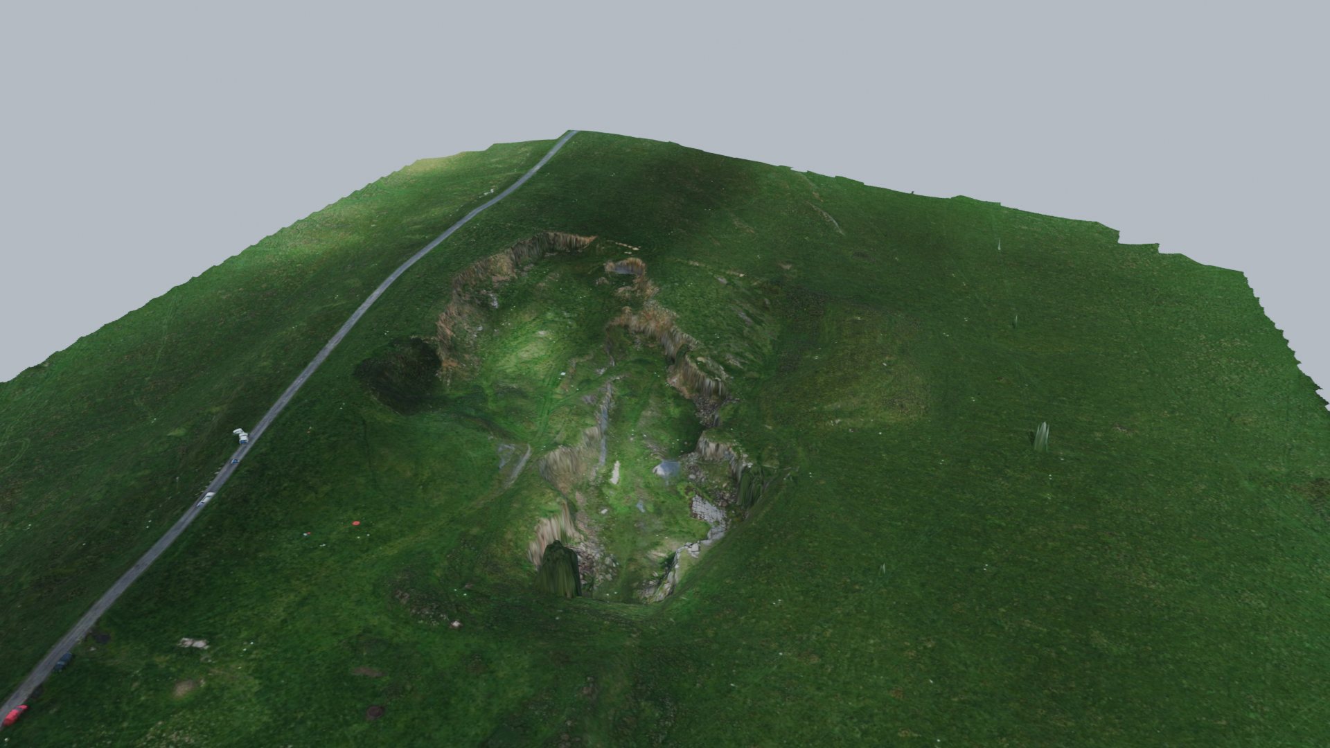
WARDS HILL QUARRY, UK · PUBLIC BENCHMARK
500 drone images turned into a terrain model, orthophoto, point cloud and flythrough.
Wards Hill data: EuroSDR RPAS benchmark, Newcastle University (CC BY 4.0), processed by Davies Field & Flight. Town Neck data: U.S. Geological Survey (public domain).
The site boundary and your plan, or the images and point cloud by a shared folder (Google Drive, Dropbox, OneDrive) – WeTransfer is fine for smaller sets.
A fixed price, the coordinate system, what is included and what is not, within one working day.
The work, then the checks: contours against the terrain, volumes against the register, drawings checked at print size.
One zip: drawings, models, report and a short read-me. Changes usually returned within two working days.
QUESTIONS
No. We are a data-processing and CAD drafting service, not chartered surveyors, engineers or registered geometri. We work from data you or a public body supply.
Not without a check. Our drawings and volumes are for design, planning, pricing and presentation. Anything to be set out on site or used as a contract quantity must first be checked by your own surveyor or engineer.
On request. Most clients send us their own images, scans or public LiDAR; where a flight is needed we arrange it, flown by us or a local pilot, and quote it separately.
British National Grid with ODN heights, Irish Transverse Mercator, UTM and others. Whatever your project uses, stated on every sheet; the height datum and any geoid correction are declared on the drawing, never assumed.
Public Environment Agency LiDAR is accurate to about 15 cm in height. A drone LiDAR survey flown for your site is better; what it achieves depends on the control flown with it, so we report the figure measured on your check points rather than quote one in advance. Either way, the drawing states the accuracy of the source, measured on your check points where you have them.
Kept on a private drive for the job and deleted 60 days after delivery, unless you ask us to keep it.
SEND A DATASET
Where it is, what you have (boundary, plan, images, point cloud) and what you need back. A fixed quote follows within one working day.